Showing posts with label northwest. Show all posts

Sunday, April 13, 2014

Tulips, Tulips, Tulips

After living in the Portland area for eight years, I decided it was high time to visit the Wooden Shoe Tulip Farm in Woodburn. Each year the tulip festival is held from the end of March to the beginning of May. There are daily activities and huge fields of tulips to wander in. 

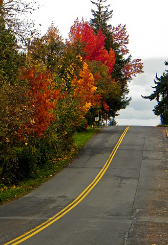
Woodburn is about 35 minutes south of Portland so it's not like it's a long way to go, but the two main reasons I've never gone are the entry fee of $10 a car and the crowds. Those who know me know that I have made saving money into a game, as in "what's the cheapest way to do X." The fee for bicycles and motorcycles was five dollars and that seemed more reasonable. I hate finding a parking place in crowded lots, so I found a shopping area about six miles from the festival and decided to combine exercise and photography. After an argument with my GPS (I won), I found the shopping area, parked the car, and set off. One of the other reasons I decided to walk (besides having grown fond of the money in m pocket) is there are always things to see along the way that would be missed while driving.
There were several old barns and vineyards that caught my eye, and even some bison. Except for the cars whizzing by seemingly not paying attention to the scenery, it was a nice walk.
This was a sign at a local farm, one that I could easily appreciate!


There was a long line of cars making its way to the farm and it didn't take me long to realize I was glad I was walking because at some point all those cars were going to be driving back and the thought of it made me claustrophobic. I made my way to the parking lot and asked the woman directing traffic if there was another place I could pay to get in. The idea of wading through all the traffic to the entry booth didn't appeal to me much. The woman directed me to the gift shop and I made my way there and asked how much it would be to get in. The woman behind the counter was a bit stumped and asked someone else what they thought. Apparently, no one else has ever walked in (or if they have, they didn't make their presence known). After a few seconds of deliberation, the woman said not to worry about it. That sounded like a good deal to me so I made my way to the tulip fields. Not ever having been there, I had no idea what to expect.

The fields looked like an enormous banner painted on the ground. Next to the splashes of muliple colored blooms, followed row upon row of red, yellow, purple, and white. Joseph and his coat of many colors would have disappeared in the swirling rainbow.

Part of the fun was taking a picture without including someone's head or hand. It rather resembled a game Atari might have come up with, except instead of shooting the space ships, the object was to shoot between them. 

There's something addictive about beauty. No matter how many pictures I had, I just had to take one more. The result of course was numerous shots of almost exactly the same thing. At least pictures aren't high in calories.


After about an hour, which went by in a surprisingly short time, I headed back to where I had left my car. By now, the two miles from the farm to the main road was a solid mass of cars. The trend continued after I turned onto the state highway and the train of cars snaked its way back for at least another three miles. Four different people asked me if I knew what was going on or where the wreck was. My favorite car contained a happy looking octogenarian who waved at me as I walked by. She didn't seem to mind the wait as she took in the slowly moving scenery. Before long, I was back to one of the barns I had passed earlier.

Surprisingly, things sometimes look different on the return trip. There's probably something philosophical in that statement, but since a picture is supposed to be worth a thousand words, I'll let it do the talking.


Sunday, November 24, 2013

Last week I decided that it was time to take a Friday off work. After all, it had been over a whole month since the last time I'd taken a Friday off so I figured it was time. Besides, it had suddenly occurred to me that after next week the malls and stores were going to be clogged with shoppers. As much as I love shopping (and those of you who know me can attest to this), the week before Thanksgiving suddenly seemed like a good time to get the Christmas shopping that couldn't be done online over with. The fact that the sun would be shining never entered into the equation and turned out to be a bonus. Unfortunately, the wind was also blowing for two of the three days of the long weekend. I have a strong aversion to wind. It must be a leftover hangup from living in the southwest for so long and putting up with what amounted to a sandstorm every afternoon during the month of March. Now whenever I hear the wind howling outside, all I can think of is the blowing dirt and static electricity.

Up here, it's more likely for there to be blowing moss than sand, so I made several forays down the hill to see what there was to see in this unexpected sunlight. One of my favorite areas is not far from home and has old farmhouses alongside newer additions. This area was once an orchard and there is still a large parcel of land in the middle of the neighborhood that, by a covenant or code of some kind, must remain in its natural state. There are pear, plum, and apple trees tucked back here, although the blackberries make them rather difficult to get to. This picture is taken near that now wild orchard. Something else that is rare to see during this time of year is a good sunrise or sunset. The sky and cloud conditions have been nearly perfect these last few days and because my apartment has a southwestern exposure, I don't have to go far to see a great sunset. The biggest trick is not getting hit in the head by a hanging flowerpot.

Saturday was much like Friday as far as the weather was concerned. After a nice run, I decided to go for another walk while the sun was still high overhead. Because of all the tall evergreens, it doesn't take long for streets to be completely in the shade. The only problem was that my fingers (which have circulatory issues in the colder weather) had turned white and numb and taking pictures was a bit frustrating. It felt like I was really pressing the button hard on the camera and nothing would happen. It's amazing the difference a little constriction makes in finger strength. However, after a lot of blowing on my fingers and rubbing my hands together, I did get enough feeling in my hands to get a few pictures. There's a lovely path along the Willamette River but right now the water is low enough to walk right along the edge of it. That won't be the case by next month. Sunday was the perfect day. It was chilly in the shade, but in the full strength of the sun it was quite luxurious and there was only the vaguest hint of a breeze. I decided to do a longer version of  Saturday's walk and went back to the same southwest Portland neighborhood. This time though, I walked across the Sellwood bridge and into Oaks Bottom Wildlife Refuge. In the spring there's a purple haze of flowers along the floor of the park but this time of year it's just golds, reds, and browns. It's
easy to forget that downtown Portland is just a few miles away while walking through this area. If I didn't raise my eyes too high, I could almost pretend there were no high rises peeking over the reeds and bushes. On my way back, winding through the Sellwood neighborhood, I was struck by the number of flowers that were still in bloom. This was the perfect time of day and the sunlight shining through the red was eye-catching. I wish this weather could hang around for a bit longer, say until about June. But I suppose that's asking a bit much.


 This was taken on the way down to Macadam along a series of staircases that goes from the top of one Portland neighborhood to the foot of the hill. These blooms are going to get a rude awakening in a few weeks.


Saturday, October 19, 2013

(Mis)Adventures in Boating

Several weeks ago, a couple who attend the same church that I do invited me to visit them at their house on Oswego Lake and go for a boat ride. Here's a little lake history, back in the day it was called Sucker Lake (charming name, isn't it?). There are different stories about how it's a man-made lake but also was formed during the Missoula Flood. Perhaps the truth is a combination of the two. The lake is joined to the Willamette River by Sucker Creek, and there is also at least one canal joining it to the Tualatin River. In the late 1800's it was used to transport iron from the local iron mine down to the smelter, which was several miles away at what is now George Rogers Park. Now, it's a private lake owned and maintained by those who live around it. There is public swimming access, but if the idea is staying above the water, that's another story.

When Leon invited me to come take pictures, I jumped at the chance. After living in Lake Oswego for eight years, the closest I'd gotten to the lake was the "Duck Pond" in downtown. The view from their house was captivating enough, and I couldn't wait to go for a boat ride. However, the matter of a large bit of a canvas barrier that was part of the remodel next door getting caught in the boat's propeller, prop, blade, etc., caused a bit of a delay. While Leon was busy untangling the cloth, Sharon got out the paddle boards and gave me a quick lesson on how to ride one without taking a nose dive. Ever since I've seen groups of kids gliding along the surface of the water, I've wanted to try this. It wasn't as difficult as I thought it would be, and after a few minutes I was headed off for a quick tour. I knew all those years riding skateboards when I was a kid would come in handy.

After about 20 minutes, Leon drove the boat out, free of its slimy canvas entanglements. We then headed off under the little bridge on North Shore Drive and out into the "big lake." And it was certainly bigger than I realized. As many times as I've run, walked, or driven around it, I never realized how vast it really was.
The sun was not in the ideal spot on the way out, but I wasn't complaining. Leon told me about the history of the homes as we went by and stopped to let me take pictures of anything interesting, which was about every five feet.

Things were going swimmingly (no pun intended), when all of a sudden there was silence instead of boat motor noise. After numerous attempts to get the engine started and attempting to flag down the only blind boater on the lake, Leon got out the oar and paddled us to the nearest dock. We tied the boat up and went up the stairs to find out who our new best friends would be. Of course, I had to take a picture because it was a really nice view. Unfortunately, no one was home at
either of those homes, so we trooped next door and down more stairs. The lady of the house let Leon use her phone to call the lake patrol. They are a group of off-duty firemen who help rescue boaters and patrol the lake to make sure everyone is following the rules. Of course, this particular day, no one was on duty. So, back to the boat and into the lake to try and flag down a good Samaritan.

This time we were more successful, and some very nice people towed us all the way back home. It was a much slower ride back, but it gave me more chances to enjoy the scenery.  The house below is also known as Casablanca, and for good reason. It was once occupied by Humphrey Bogart and his wife Mayo Methot, the wife before Lauren Bacall. We soon

 were safely back and thanked our rescuers, who happened to live right across the bay from Leon and Sharon. They were both so apologetic, but there was no reason to be. I'm now assured of more visits out there to make up for all the mishaps that happened on this one.

Sunday, October 6, 2013

To the Lighthouse

Yes, I know, Virginia Woolf already wrote that story. But in this instance I really was trying to get to a lighthouse, just without all the angst associated with the other story. One of my favorite spots in the area is Sauvie Island. It has a small lighthouse on an equally small outcropping of rock called Warrior Rock. The story goes that in the late 1700's a British Naval expedition landed on Sauvie Island and was greeted by warriors of the Multnomah tribe. There was some trading between the two groups, and the point where they met was called Warrior Rock to commemorate the occasion. The lighthouse, Oregon's smallest and one of only two Oregon lighthouses not on the Pacific Ocean, guides river traffic on the Columbia. I have had several past attempts at hiking out to the lighthouse and Friday's adventure was yet another failed attempt, but at least this time I actually caught a glimpse of it. With a little imagination, the lighthouse can be seen at the end of the line of trees on the left in the picture above. Well, with maybe more than just a little imagination.

I had decided that the first sunny Friday in October I would take a vacation day  to capture some fall colors. I was hoping it would be a little later in the month when there was more color, but when you live in such a temperamental state you take any sunny day you can get no matter when it comes along. So when this past Friday was predicted to be 70 and sunny, I put in my vacation request. When I left Portland around 9:30 in the morning it was almost clear. As I got closer and closer to Sauvie Island, it got cloudier and cloudier. I was not amused. I parked at one of the designated areas and started walking, looking for any sign of blue sky in the middle of all the gray. Finally, about noon, the skies started to clear. I sat on an old fallen tree eating carrots and humus and thoroughly enjoying the scene before me.

This particular part of the island has little traffic, especially this time of year, and each time I've been there it has the feeling of walking through a landscape painting or a picture in an old story book. This area has a trail that runs roughly parallel with the main road and then intersects it at a point where the other road turns to gravel. I was heading for this intersection and just happened to look over my shoulder to see a mountain peering at me over the canal.


Once the two roads intersect, it's a long straight walk to the trail head. There are numerous signs for Collins Beach along the way, which is a clothing optional spot. I was half tempted to jump out of the underbrush with my camera aimed at any unsuspecting sunbather just to see if I could get anyone to scurry away to take cover, but I decided I better not. After passing numerous cows and old barns, I finally found my way to the beach. I was going to take the trail out to the lighthouse and follow the coastline back but there was some trail construction going on so I decided to go out and back the same way.

 Mt. St. Helens, Mt. Adams (I just found out that the mountain I'd thought was Rainier all these years is actually Mt. Adams), and Mt. Hood were all out with their fresh layers of snow. I thought this time I would make it all the way for sure, but alas it was not to be. The beach soon became a sea of mud and the trail was almost as bad. I could feel my shoes being sucked off my feet and decided it would have to wait yet again. I'm sure the lighthouse isn't going anywhere soon and it will give me another excuse to drive back to the island next summer or spring.


Sunday, July 14, 2013

Wide Open Spaces

It struck me yesterday, as I realized that once again I had planned too long a walk to possibly fit into one day, that the ultimate goal shouldn't necessarily be getting to the planned destination, but rather enjoying what there is to see along the way. Sauvie Island is a good example of a place where it's easy to forget about the finish line and just enjoy the journey. Yesterday morning found me yet again on Highway 30 on the way to Sauvie Island. This has become one of my favorite places to visit, even more so than the Columbia River Gorge, for one simple reason: wide open spaces. When I drove across the bridge, I immediately pulled out of the car to snap this picture of Mt. St. Helens. And guess what? There were no trees to dodge, no hills in the way, just farmland and a few trees to decorate the foreground.

After wending along past mown fields of alfalfa and farmhouses, I came to the first of many parking areas on this island that is a combination of nature reserves and farmland. I should have checked the handy dandy GPS to see how far it was to Warrior Rock and the lighthouse but figured it hadn't looked that far when I checked the map earlier and probably wasn't more than five or six miles to the trail head, add another six-mile round trip to see the lighthouse and it equaled a decent walk for the day. Except that, as usual, there was a slight miscalculation and after about four miles I checked and saw that it was going to be at least seven more miles to the trail head. Eighteen to twenty miles is one thing, thirty is a (very) far distant goal. At that point, I decided to look for a loop that would take me back another way so I could check out different scenery. The lighthouse will have to wait until another day. It probably isn't going anywhere any time soon. A dirt road curved off the main drag just past the beach parking area and took me off the beaten path into fields of yellow flowers (probably weeds, but they look good in pictures) and along a dirt trail that ran alongside one of the many lakes on the island. Here, except for the wind whistling past, it was quiet and easy to forget that there was a bustling city about 10 miles away.
The road made its way up a gentle rise until Mt. St. Helens was again on the horizon. That sight alone made the day worth it and it, and made me realize how blessed I am to be a desert rat in the northwest.


Friday, June 7, 2013

Eagle Creek Falls Trail

The Eagle Creek Falls trail hike is one I've done before, but certain trails quickly become old friends that you want to revisit each year. The trail head is about half a mile from the parking lot, but this year my curiosity got the better of me. There is a mysterious staircase that appears near the exit ramp that leads to the parking lot. The staircase connects what used to be the original Columbia River Highway with the highway-turned-bike path that runs along Interstate 84. I decided that this year I was going to explore the stairs before starting on the hike. In my research with Google maps, it appeared I could take the stairs to the old highway and would eventually find a trail that would take me the back way to a footbridge that crosses the creek. That would then spit me out near the trail head and both satisfy my curiosity about the bridge and give me a different way to the trail head. I went up the stairs and continued following the old highway until I passed a sign for a trail that seemed to be going in the right direction, so seeing a fork in the road, I took it. After a bit, the trail came to another junction, but I continued on the original trail. That's where I made my mistake because after another five minutes I started to get the feeling of déjà vu all over again and before long I was back on the old highway. I realized later that I should have turned onto the other trail at the junction and that would have taken me to the bridge. Well, there's always next time.

Eagle Creek trail is fairly level, which is one of the reasons I like it, and for the first two miles is made up of mostly packed dirt with a loose rock here and there. Eagle Creek is actually a tributary of the Columbia River and hosts a number of waterfalls along the way as the trail runs parallel with the rushing water. I think the word creek is rather misleading because it has all the sound and speed of a serious river. The first waterfall on the way is Punchbowl Falls. The trail to Punchbowl intersects with the mail trail, but the junction is easy to miss, even with the great signage at about a foot above eye-level. From the riverbed, the falls is around a corner and to the left. Depending on the time of year, it's very easy to walk out on the rocky "beach" to get a look at the falls. However, a week after one of the rainiest Mays on record is not the time of year to do that. Let's just say I spent some time dumping water from my shoes and wringing out my socks, but it was worth it.

I often wondered why it was called Punchbowl Falls because, frankly, I've never seen a punch bowl in the shape of a waterfall. However, this time I did a little exploring after finding a non-official trail that led down to a ledge overlooking the top of the falls. From there, it was easy to see the perfectly round bowl that the water flowed into and then the name made sense. The picture below and to the right looks through the gap and into the area where the picture of the actual falls was taken. The sound of the water was so loud but at the same time relaxing. There are several campsites along the river and going to sleep while listening to the churning water is my idea of a perfect vacation.

Punchbowl Falls is only about two miles in, and my next goal wasn't until mile six. Meanwhile, the trail went from broad and smooth to narrow and rocky (this rather reminded me of the part in Pilgrim's Progress where Christian would much rather walk on the smooth trail that appeared to parallel the rocky trail he had been told to stay on). At times, there are thick steel cables firmly fastened into the rock to give anyone who might have a touch of dizziness or slippery footedness a way to reestablish their balance. But it's also at these places that the view is the best. 

Tunnel Falls is right in the middle of such a section of trail. The water thunders over the cliff and down 130 feet with a force that is absolutely amazing. It's called Tunnel Falls because the narrow trail leads through a tunnel that was carved into the rock behind the falls. In the picture on the left there can be seen, with a bit of imagination, a little "Hobbit hole" to the left of the falls and about half way down. It's reassuring to have the cable here because this is often a somewhat crowded section of the trail as everyone lines up to take pictures and becomes totally oblivious to everything else.


The next "favorite" has at least two names: Crisscross Falls, Twister Falls, and probably others I don't know about. Either one will do. It's actually higher than Tunnel Falls by about 10 feet but because the trail is above it, it doesn't seem that the water is falling so far. It's quite easy to stand right at the top of the falls without any fear of falling in and snap away with the camera. At least, that's what someone told me. The rainbow dancing on the edge of the water immediately caught my eye, and I was quite thankful that the camera could sense it. I've never been to Hawaii, but I always picture rainbows in the water there and I'm glad I didn't have to go so far to see them. I hovered around this spot for a while, just taking in the wonderful noise of the water and feeling the warmth of the sun before starting the seven-mile trip back. I admit to complaining about the rain every now and then in the Northwest (okay, I complain a lot about the rain in the Northwest) but being able to stand on the edge of a waterfall and only be 45 minutes from civilization makes up for all those gloomy wintery days.


Friday, March 8, 2013

Surprised by Spring

Finally, spring! I know, it's not quite spring yet, but we're closer to it than we are to the first day of winter. Spring surprises come in many shapes. For instance, hearing a mechanical voice outside the bedroom door at 10:30 at night telling you the smoke alarm battery is low is definitely a surprise. I had no idea my heart could beat that hard and still be inaudible. But that's not exactly what I had in mind.

Spring creeps up on you in many ways in the Northwest. Growing up in New Mexico, the month of March would blow in and by the time the dust settled, it was warm and things were blooming. That's not exactly what I would call subtle. But here there are small changes every day, and before you know it the bare tree outside the window is covered in blooms. Or the dark gray sunrises of winter change to a brilliant palette of color smeared across the sky, rather like a three-year old's finger painting without the mess.

Animals are another fun part of spring. During the winter about the only wildlife you see is the neighbor's dog out for a walk. Granted, a squirrel isn't exactly exotic, but coming around the corner and seeing one perched in a tree posing for a picture is unexpected. He performed quite a nice gymnastics routine on the highbars too before going on his merry way. Then there was the rare black hummingbird. Not really, it's more like the silhouette of a hummingbird. My one complaint (okay, I have many, but for now) is the light this time of year. There is just enough to backlight but not really illuminate. At least hummingbirds are quite distinct, which makes this a more satisfying capture than the ubiquitous blackbirds that dot the landscape. And finally, there's the rain. Yes, it rains in Oregon (surprise!), but after the rain is a great time to be outside. I love finding raindrops on roses (sorry, daffodils) and capturing them before they fall to the ground. Yes, spring in the Northwest is both frustrating and satisfying. One minute the sun is out and the next it's pouring rain. But even with its temperamental nature, spring brings a different feel in the air that is instantly recognizable after a long gray winter.

Friday, November 9, 2012

The Road Taken

DSCN7684-110912
DSCN7822-110912DSCN7675-110912DSCN7746-110912Two roads diverged in a yellow wood, oh wait, someone else already thought of that opening line. I had to memorize Frost's poem in sixth or seventh grade (I had the same English teacher both years so it's hard to remember exactly when) and every Fall those opening lines come to mind. It is very easy to find roads winding off and disappearing into a haze of yellow this time of year. But in a few weeks even that haze will be gone, and only the evergreens will be providing color along the roadside. Instead of the road dividing, as in Frost's poem, here there's always another bend to take, the yellow dividing line becoming camouflaged with the leaves. The trick is get the picture before the car(s) come roaring around the bend. Most of them are not thinking about Robert Frost or the leaves swishing under the tires but instead are focused on where they're going and how fast they can get there. I'm sure there were several drivers who thought I was taking their picture as they came around the curve, like some incognito law enforcement officer with a high tech radar gun disguised to look like a harmless Nikon camera. I stood in the cold for quite some time waiting for the single car that kept going by (I swear it was the same one each time) to get out of the frame, all the while expecting to hear police sirens no doubt responding to a report that a suspicious character was standing around staring into the distance. Then again, the red trees along the road made a sight worth staring at. But not all cars are photographic interlopers. I was so glad my camera was out when this truck came by. Instead of muttering under my breath as in the prior instances, this was one vehicle I was glad to see.