Monday, September 2, 2013

Adventures in Bushwhacking

During all the walks and hikes I've taken in the Portland area, there have been a few times when I wished I had a machete in my back pocket, was lost, or just couldn't get there from here. Today was a bit of the former and a sprinkling of the latter. My initial goal was a hunk of what is called Waverly Heights Basalt in the Willamette River (I'm not sure if the basalt is named for the local golf course or the other way around), that is thought to have been formed by ancient lava flows. The current name for this hunk of rock is Elk Rock Island. The island is easily accessible at all times by boat but, unless a person feels like doing a bit of wading, the easiest time to get there on foot is during the summer when the water is low. In the early 1900's, a dance club was situated on the island, and in 1910 Portland businessman Peter Kerr bought the island from the Rock Island Club. In 1940 he donated it to the city with the requirement that it be kept in its natural state for, as he put it, all to enjoy. Kerr's own home was across from the island, resting on a cliff of the same basalt as the island. Now that the history has been laid out, here's what happened. I parked my car on the north side of Willamette Park, because traffic across the Sellwood Bridge has been hideous lately, and the journey is as much the point as the destination. I quickly got distracted in Willamette Park by a trail down to the river that in the spring is nothing more than a place to fall into the water, but at the end of the summer it's more like walking onto someone's lawn.

I continued along the riverbank intending to rejoin the trail later. But after about seven or eight minutes, it seemed simpler to keep going until I met with an unofficial trail back to the link between the park and a nearby marina and then the street to the bridge. The slight hiccup was that all the entrances to that link between the park and the marina had been blocked due to the construction going on at the Sellwood Bridge, and I do mean all entrances. I found myself below the wooden walkway that leads from the marina parking lot to the houseboats looking up at the imposing chainlink fences topped by razor wire and thinking maybe I should have turned around sooner. But never one to accept the obvious conclusion staring me in the face, I decided there had to be a way around this. And lo and behold there it was. The gate to the marina parking lot may have been topped by razor wire but that doesn't matter when it's not latched. I made my way through the gate thinking I was home free, only to be faced with a long gate across the entrance to the parking lot. It was the kind that residents have codes to, which did me absolutely no good. I walked around the inside of the lot looking for any kind of opening in the chainlink and, finding none, tried to figure out what part of me besides my arm, backpack, and camera would fit through the narrow gap between the wall and gate. I said a short prayer and right then, a resident returned home and unlocked the gate. He didn't seem distressed to see some potential criminal wandering around inside the area and I told him what happened and went on my way.

After that, getting to Elk Rock was easy. It was no problem getting on the island as the water from the spring was now no more than a few puddles. Trails criss-cross all through the island and around the perimeter. There were other people there enjoying the sun or the view, but at the same time it was easy to feel quite isolated.

As I headed back, I fell into step with a very nice couple who lived along the Columbia River in north Portland. They had come as far as the trail would let them before running into the island. We chatted until they turned to go a different direction and it struck me that if I hadn't taken so long to get to the island in the first place I would have missed out on their enjoyable conversation. The next time an apparent inconvenience comes my way, I'll have to remind myself that a momentary frustration can also lead to an enjoyable memory.


Saturday, August 10, 2013

Herding Cats Part 2

When we last heard from our feline heroes, they had just arrived at Mount Allison University in Sackville, New Brunswick. The campus was lovely and was situated in the middle of downtown (although, Sackville is quite small and downtown quickly becomes the edge of town). I'm not sure what style the buildings were, but whatever it was, it was photogenic.

After checking into rooms and semi-unpacking, some of us went exploring (and running on the track to get loosened up). There was a waterfowl park on the edge of the campus that wondered through bulrushes and over a large lake/pond and through the birch trees. It was especially beautiful at sunrise, just watch out for vampires masquerading as mosquitoes. I spent a lot of time here in the afternoon after dancing all morning. A trail ran through the park and by way of a detour crossed over the highway and continued on indefinitely through "Middle Sackville" and beyond. Saturday was the only chance I had to really explore this trail and that wasn't for as long as I would have liked. It was mostly farmland all along the way with church steeples peeping over the trees.

Our week at Mount Allison wasn't nearly long enough, but at least it was very scenic while we were there. And everyone knows kitty's love scenery.

Next up - cat herding to Prince Edward Island.

Thursday, August 8, 2013

Herding Cats from Oregon to Prince Edward Island

I'm unclear as to the generally accepted method of herding cats. I would assume it involves a fair amount of cream and catnip. However, in the case of human cats, it can be a bit trickier. Recently, seven of us Scottish Country dancers took a crash course in cat herding as we traveled from Portland, Oregon to Portland, Maine and then on to New Brunswick and Prince Edward Island (or PEI for those who get tired of typing the entire name each time). The occasion for our travels was an annual event called Summer School that is put on by Teacher's Association of Canada, a large organization for Scottish Country dancers in North America. Each year Summer School is held in a different city. Last year it made its debut in the U.S. in Portland, Oregon and this year it was in the town of Sackville, New Brunswick.

The seven of us left Oregon early on a Thursday and arrived in Portland, Maine after what seemed like days later. Our plan was to tour parts of Maine and take our time driving from there to New Brunswick. The weather was not as cooperative as we would have liked that first day in Maine, and our trip to Acadia National Park and Bar Harbor got about as soggy as imaginable.

It was still beautiful though, and my poor camera got quite the bath as I kept taking it in and out of its case. The rain had come down so hard that waterfalls poured onto the street on the drive up to Cadillac Mountain in Acadia National Park. We weren't the only car to pull over to the side to take pictures of the cascading water as it rushed down to the road. Another stop in Acadia was Thunder Hole. Whenever the right-sized wave hits a particular inlet, the resulting sound is a thunder clap that makes the Fourth of July fireworks display seem tame by comparison. The waves were in full force that day with the rain storms and I had to admit that if it had been nice weather, I would have missed out on this awesome display of raw power.

After spending the day in the rain, it felt good to go back to the friend's house where were staying and dry off. Some decided it was the perfect excuse for a lobster feast and afterwards we all played a card game version of Scrabble (and of course quibbled over whether or not certain words were really words or not).

The next day it was off to Canada. We stopped several times along the way and at each stop our cat-like characteristics became more pronounced. It's amazing how quickly seven people can jump out of the car and head off in seven different directions. Getting us all corralled became increasing frustrating for the designated cat herder. One of the more interesting towns we stopped in was St. John. It had a mini-Pike Street Market there as well as a number of interesting buildings and places to explore. Our course took us along the Bay of Fundy and it was so hard to stay still in the car as the beautiful scenes flashed past. I took a number of shots through the windshield, and I'm sure everyone in the car was tired of hearing the clicking sounds of the camera every other second.

Soon we were at our rooms in Hillsborough, New Brunswick, that is after a brief argument with Google maps which insisted the motel was located somewhere on a dirt road. The motel was situated along the Chocolate River, which certainly lived up to its name. I took a walk early the next morning and the combination of the pinky brown of the river against the blue/gray sky was very striking. The next morning we traveled to Hopewell Rocks, located on the upper shores of the Bay of Fundy. These are unique rock formations that, depending on the time of day, can either be walked up to or kayaked around. We arrived just after the park opened and soon the place was abuzz with visitors. It was difficult to get shots without people and after a while I just gave up. The lighting was particularly flat and gray but it was still a lovely place to visit. Sunrise or sunset would be magical. From there we drove on to Moncton and then to Sackville where we checked in for our week long stay at Mount Allison University. It was an absolutely beautiful spot, which will be covered in the next installment. (insert cliff hanger music here)


Sunday, July 14, 2013

Wide Open Spaces

It struck me yesterday, as I realized that once again I had planned too long a walk to possibly fit into one day, that the ultimate goal shouldn't necessarily be getting to the planned destination, but rather enjoying what there is to see along the way. Sauvie Island is a good example of a place where it's easy to forget about the finish line and just enjoy the journey. Yesterday morning found me yet again on Highway 30 on the way to Sauvie Island. This has become one of my favorite places to visit, even more so than the Columbia River Gorge, for one simple reason: wide open spaces. When I drove across the bridge, I immediately pulled out of the car to snap this picture of Mt. St. Helens. And guess what? There were no trees to dodge, no hills in the way, just farmland and a few trees to decorate the foreground.

After wending along past mown fields of alfalfa and farmhouses, I came to the first of many parking areas on this island that is a combination of nature reserves and farmland. I should have checked the handy dandy GPS to see how far it was to Warrior Rock and the lighthouse but figured it hadn't looked that far when I checked the map earlier and probably wasn't more than five or six miles to the trail head, add another six-mile round trip to see the lighthouse and it equaled a decent walk for the day. Except that, as usual, there was a slight miscalculation and after about four miles I checked and saw that it was going to be at least seven more miles to the trail head. Eighteen to twenty miles is one thing, thirty is a (very) far distant goal. At that point, I decided to look for a loop that would take me back another way so I could check out different scenery. The lighthouse will have to wait until another day. It probably isn't going anywhere any time soon. A dirt road curved off the main drag just past the beach parking area and took me off the beaten path into fields of yellow flowers (probably weeds, but they look good in pictures) and along a dirt trail that ran alongside one of the many lakes on the island. Here, except for the wind whistling past, it was quiet and easy to forget that there was a bustling city about 10 miles away.
The road made its way up a gentle rise until Mt. St. Helens was again on the horizon. That sight alone made the day worth it and it, and made me realize how blessed I am to be a desert rat in the northwest.


Sunday, June 30, 2013

North by Norhtwest

One of the things I've come to appreciate about the Portland area is its diversity, and I don't mean the politically correct version of the word that is so popular now. By diversity I mean all the different areas you can visit in one day within about a three-mile radius (in this case, forest, city, and island). This past week has been absolutely perfect as far as weather is concerned. Summer normally doesn't come until July 5, but at least for now it's here in full force. Since there was no reason to wait for the clouds to clear or the sun to come out, I headed to northwest Portland early on to begin an urban hike. I drove across the St. John's Bridge and parked in one of the neighborhoods across from Cathedral Park. Driving across bridges takes no time at all, but walking back across is another story. The St. John's Bridge is no exception, but at least it's got a pretty view on the way.
 From up here, it was very easy to see Mt. Hood wreathed in clouds behind the Steel Bridge, as if it just couldn't quite step out of its comfy white cloak. After crossing the bridge, I found the steps that lead up to the Ridge Trail, part of the Wildwood Trail system that makes an approximately 40-mile loop through Forest Park. There were glimpses of the bridge through the trees, and it didn't take long to be almost level with the Gothic spires. The trail wound its way up for some time (much farther and twistier than Google showed, how surprising!) until it joined Leif Erikson Drive. The word "drive" is misleading because really it's a wide dirt multi-use trail, as in bikers, runners, dads with strollers, probably even unicycles at times (the bagpiping Gandolph can't always be riding in downtown, right?) so there was plenty of traffic to keep one from feeling too lonely. There are also well-placed maps at different junctions to keep hikers from getting lost, well usually. There was one intersection where the signage was particularly unhelpful and it does no good to look for moss on the north side of a tree because moss grows on all sides and surfaces.
Enough sunlight does filter in to allow certain varieties of flowers to grow. I have no idea what the flowers on the left are, but they rather remind me of inflated turbans. Columbine also makes an occasional appearance, and it's almost always in this red and yellow combination. At times the trail had rather a Shire look to it. If it wasn't for the posts on the side of the bridge, you could almost imagine elves (and yes I know, elves aren't technically in the Shire) making their way over the stream and tripping lightly up the steps, as opposed to hobbits who don't do anything lightly with those hairy feet.

 I took a wrong turn here and went up the steps because I've learned in the past that when in doubt, go up. This time the "up" trail appears to have been a shortcut to the back side of one of the businesses along Highway 30. I retraced my steps and went along the trail that paralleled the stream. It was then less than a quarter of a mile back to the highway and along the raised sidewalks that are part of what used to be the community of Linnton. From what little research I've done, Linnton used to be a thriving town. That changed when the highway was widened and the roadside businesses became level asphalt. There are still some homes dotting the landscape and businesses along the east side of the highway but apparently it never recovered its past glory. One of the things left behind was a series of staircases and raised sidewalks that allowed the townsfolk easier access to bus stops and businesses. Those are on the agenda for a future hike.

It was at least a mile or so back to the car and on the way I explored the block-wide farmers market on the east side of the St. John's Bridge. There was everything from local berries to salsa and tamales and crepes. Good thing I didn't have any cash or I might have spent it.

Next it was off to Sauvies Island to pick berries. This past week, a co-worker mentioned that her daughter and boyfriend had picked berries at Sauvies Island Farms and that at $2 a pound, the berries were much cheaper than those at the farmers market. I'm not sure if the cheapness factor holds up when you calculate gas, time, and effort, but it was still a fun way to spend the afternoon. The island is connected to the highway by a bridge that crosses the Willamette River. Along the river are houseboats and the area is dotted with farms. I usually leave my car at the park and ride and walk along the road to whatever the destination is. It always feels like walking in a postcard, that is if you ignore the cars that whiz by on their way to the local beach. The clouds were just beginning to clear from the mountains and the fields of flowers made a great foreground. The sprinklers were an unfortunate distraction but you can't arrange real life very easily.

 After about a three-mile walk, I was at the farm. A lady at the entrance was directing people to the proper fields and giving out cardboard flats to hold berries. The road to the berry patch had a view of Mt. St. Helens and flower patches along the way. Lavender, daisies, hydrangeas, and lilies were growing side by side waiting to be picked and turned into a bouquet. After passing corn, cabbage, kale, and other veggies, I finally found the raspberry section. The berries were the size of medium strawberries and were growing in abundance. It was no time at all before my container was filled and it was off to the blueberry patch. Again, the berries were huge and picking berries in a civilized field was quite a pleasant switch from picking thorny blackberries on the side of the road.

On the way back, I was struck again by the beauty of Mt. Hood with the flowers in front of it. Ignoring the idea that I should put my cardboard flat loaded with three plastic containers of berries down before taking the picture, I tried holding the flat and taking the picture. Let's just say, it didn't work. I was down on my knees picking up blueberries when I looked up and realized this was actually the best angle for the picture. Someone on their hands and knees picking up blueberries and then taking pictures probably looked pretty crazy to those driving by, but if I ever see those people again they won't recognize me anyway so it doesn't matter.
.

Friday, June 7, 2013

Eagle Creek Falls Trail

The Eagle Creek Falls trail hike is one I've done before, but certain trails quickly become old friends that you want to revisit each year. The trail head is about half a mile from the parking lot, but this year my curiosity got the better of me. There is a mysterious staircase that appears near the exit ramp that leads to the parking lot. The staircase connects what used to be the original Columbia River Highway with the highway-turned-bike path that runs along Interstate 84. I decided that this year I was going to explore the stairs before starting on the hike. In my research with Google maps, it appeared I could take the stairs to the old highway and would eventually find a trail that would take me the back way to a footbridge that crosses the creek. That would then spit me out near the trail head and both satisfy my curiosity about the bridge and give me a different way to the trail head. I went up the stairs and continued following the old highway until I passed a sign for a trail that seemed to be going in the right direction, so seeing a fork in the road, I took it. After a bit, the trail came to another junction, but I continued on the original trail. That's where I made my mistake because after another five minutes I started to get the feeling of déjà vu all over again and before long I was back on the old highway. I realized later that I should have turned onto the other trail at the junction and that would have taken me to the bridge. Well, there's always next time.

Eagle Creek trail is fairly level, which is one of the reasons I like it, and for the first two miles is made up of mostly packed dirt with a loose rock here and there. Eagle Creek is actually a tributary of the Columbia River and hosts a number of waterfalls along the way as the trail runs parallel with the rushing water. I think the word creek is rather misleading because it has all the sound and speed of a serious river. The first waterfall on the way is Punchbowl Falls. The trail to Punchbowl intersects with the mail trail, but the junction is easy to miss, even with the great signage at about a foot above eye-level. From the riverbed, the falls is around a corner and to the left. Depending on the time of year, it's very easy to walk out on the rocky "beach" to get a look at the falls. However, a week after one of the rainiest Mays on record is not the time of year to do that. Let's just say I spent some time dumping water from my shoes and wringing out my socks, but it was worth it.

I often wondered why it was called Punchbowl Falls because, frankly, I've never seen a punch bowl in the shape of a waterfall. However, this time I did a little exploring after finding a non-official trail that led down to a ledge overlooking the top of the falls. From there, it was easy to see the perfectly round bowl that the water flowed into and then the name made sense. The picture below and to the right looks through the gap and into the area where the picture of the actual falls was taken. The sound of the water was so loud but at the same time relaxing. There are several campsites along the river and going to sleep while listening to the churning water is my idea of a perfect vacation.

Punchbowl Falls is only about two miles in, and my next goal wasn't until mile six. Meanwhile, the trail went from broad and smooth to narrow and rocky (this rather reminded me of the part in Pilgrim's Progress where Christian would much rather walk on the smooth trail that appeared to parallel the rocky trail he had been told to stay on). At times, there are thick steel cables firmly fastened into the rock to give anyone who might have a touch of dizziness or slippery footedness a way to reestablish their balance. But it's also at these places that the view is the best. 

Tunnel Falls is right in the middle of such a section of trail. The water thunders over the cliff and down 130 feet with a force that is absolutely amazing. It's called Tunnel Falls because the narrow trail leads through a tunnel that was carved into the rock behind the falls. In the picture on the left there can be seen, with a bit of imagination, a little "Hobbit hole" to the left of the falls and about half way down. It's reassuring to have the cable here because this is often a somewhat crowded section of the trail as everyone lines up to take pictures and becomes totally oblivious to everything else.


The next "favorite" has at least two names: Crisscross Falls, Twister Falls, and probably others I don't know about. Either one will do. It's actually higher than Tunnel Falls by about 10 feet but because the trail is above it, it doesn't seem that the water is falling so far. It's quite easy to stand right at the top of the falls without any fear of falling in and snap away with the camera. At least, that's what someone told me. The rainbow dancing on the edge of the water immediately caught my eye, and I was quite thankful that the camera could sense it. I've never been to Hawaii, but I always picture rainbows in the water there and I'm glad I didn't have to go so far to see them. I hovered around this spot for a while, just taking in the wonderful noise of the water and feeling the warmth of the sun before starting the seven-mile trip back. I admit to complaining about the rain every now and then in the Northwest (okay, I complain a lot about the rain in the Northwest) but being able to stand on the edge of a waterfall and only be 45 minutes from civilization makes up for all those gloomy wintery days.


Sunday, May 26, 2013

What's in a Name

With the promise of decent, and possibly even sunny, weather this Saturday, it seemed only fitting to be outside to enjoy as much of it as possible. My first thought was to drive up north to Table Mountain near Bonneville Dam, but after a bit of hemming and hawing (I'm not sure exactly what that looks like, but it fits) I decided instead to do a day-long city/trail hike in parts of various southwest and southeast Portland suburbs that I have only driven through while on the way to somewhere else.

The trek started in George Roger's Park in Lake Oswego. Back in the day (which is a good way to say a long time ago without really knowing how long ago) this was where the iron that was mined nearby was smelted. The smelter has been restored and is now a local landmark in one of the more popular parks in town. There's a trail that runs through the park and at various times of the year has its own mini-waterfall, as well as views of the river.

After about a third of a mile, the trail comes out on Old River Road, which runs parallel to the Willamette River before dead ending into Pacific Highway. This part was the noisier part of the walk since the traffic is so heavy. I'm sure more than one person wondered what the crazy lady with the camera was doing taking pictures of shrubs, but they'll never see me again and if they do, they certainly won't recognize me without my disguise of capris pants and wild hair, oh wait, the hair is always wild. I liked the way the sun hit the droplets in this, whatever it is, rust-colored foliage. After crossing Pacific Highway, I headed for West Linn High School. According to Google maps (always a reliable source) there was a trail from the track leading up to the backside of Camassia Natural Area. I'd never been there, but a friend had told me about the abundant wild lilies that bloom every spring. I was too late for the lilies, but it was still a great place to explore. There is a wild solitude about it that is hard to describe, so I won't even try. I met a volunteer who showed me what she termed a quarry and as she was describing it, used a term associated with glaciers. Instead of appearing ignorant, I pretended to know what she was talking about, so now I'm still ignorant about what she was telling me. Oh well.   

From there, I found my way back to civilization and crossed over the bridge to Oregon City. My only association with Oregon City has to do with jury duty, but if I can keep myself from connecting it with long, boring waits in the jury room, it actually is a charming place to visit.
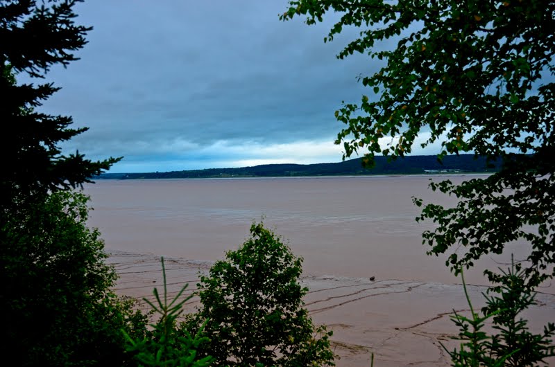
Off to one side is the Willamette Falls Dam and, to correspond with that, Willamette Falls. The roar of the water was quite distinct over the sound of traffic, even though they are some distance from the bridge.  While the falls aren't huge, there was still something impressive about them. From here, I turned left onto McLoughlin Boulevard and continued to walk parallel with the river.


My next goal was Meldrum Bar Park. About a month ago when I was walking on the west side of the Willamette, I had seen this spit of land jutting out into the river and wondered what it was. Once I discovered it's name, it went down on the list of places to explore. There were also plenty of fisherman out trying their luck. And they weren't the only ones enjoying the sun. I broke into a clearing just as this hawk circled lazily overhead. He seemed to just enjoy riding the warm air currents and expending as little energy as possible. Speaking of circling objects, I've seen rings around the sun but never in the colors of the rainbow. I managed not to stand there, rooted to the spot and pointing at the sky, but it took a bit of willpower. By this time I'd found another trail not on the GPS but which seemed to be heading in the right direction and did the logical thing by ignoring the GPS's warning that the world would end if I didn't go the right way and stayed with the trail.

At first, it seemed fairly well maintained and easy to follow, but soon that changed as it narrowed and became increasingly overgrown with blackberry bushes. My legs took quite a thrashing from the thorns, but rest assured, the blackberry bushes came through unscathed. I finally broke out into a cleared area behind some homes. As I went around a corner, I startled a heron that had been perched on a dilapidated deck. I'm not sure who was more startled, probably me because I wasn't quick enough to get the camera out. Instead I had to console myself with a picture of the empty deck.
After climbing up a small hill, I was back on paved roads and heading for the next spot, which was Elk Rock Island. Unfortunately that was about six miles away. So, I turned up the music on the ol' iPod and started to move. I'll have to come back to Elk Rock later in the summer when the river is lower and it's possible to get to it without wading through the river. Instead, I had to admire it from a distance and wonder what I was missing. Even so, from where I was it was still lovely. From here, I followed the road until it ran into yet another trail/park and then back to SE McLoughlin and into the Sellwood area. Sellwood is hard to describe. It's part hippy, part early 1900's, and all Portland. I enjoy this area because there's always something new to see. By now though, all I wanted to see was the other side of the bridge where my ride was picking me up to take me back to my car. So, what's in a name? In this case, it's Lake Oswego, West Linn, Oregon City, Gladstone, Milwaukie, and Portland. All in all, quite a mouthful.